


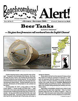
Tsunami Debris Arrives in America
Tsunami Debris Arrives in America


Figure 2. Buoy Flotation. The water line was evident on some of the Type 1 buoys. Note the line marking the separation of marine growth below the water line, and little growth above the water line. Taken together, the beachcombers’ photographs indicated that they floated on their side with half of their bodies above the water line exposed to the wind.


Figure 5. Tsunami debris off the coast of Japan. The batch of fishing buoys cradled between the roofs of two houses contains the three types of buoys which washed ashore during October, November and December along thousands of miles of coast from central Oregon north to Kodiak, Alaska. Photo by US Navy Specialist 3rd Class Alexander Tidd.
As beachcombers reported, it became clear that the photographs provided the central clues to the first arrivals. They proved to be as Rosetta stones in solving the mystery of identifying just what buoys were in fact first arrivals. The three buoy types were identified in photographs of the debris piled up on and offshore of the tsunami coast. Specifically, the three types found in America were identified in photos of fishing floats washed up in Hadenya Port on Shizugawa Bay, Minamisanriku, Japan (Figure 4). In a US Navy photo of the debris floating offshore, the three types were identified floating with two overturned vessels, the roofs of two buildings, and numerous pieces of lumber (Figures 5, 6).
— Fishing buoys from Japan’s 3.11 tsunami coast
strand from Oregon to Kodiak, Alaska
by Curtis. C. Ebbesmeyer
All rights reserved
Please reference as follows: from blog posted on January 12 at www.flotsametrics.com
Figure 1. Tsunami Debris First Arrivals — Three Types of fishing buoys: Type1 (top panel) — Cylindrical shaped hard plastic with handles at both ends, some with ribs around them. They come in black and orange; Type 2 (lower left) — Cylindrical shaped Styrofoam, some covered with canvas; and Type 3 (lower right) — Football-shaped, orange and yellow. Dave Ingraham photo collage.

Introduction
I felt like Paul Revere riding through a dark town without any lights coming on. Tsunami debris was arriving a year earlier than other sources predicted. How, beachcombers asked, could I be sure? Here’s my account as I write during the Holidays (circa December 24, 2011, to January 4, 2012). Additional data arrives daily at Beachcombers’ Alert HQ. Consult blogs at www.flotsametrics.com.
On March 11, 2011, a magnitude nine earthquake devastated northern Japan. The subsequent tsunami inundated approximately 1,300 hundred miles of coastline. As the tsunami receded, it sucked millions of tons of flotsam into coastal waters, forming a vast field of debris which is now drifting across the North Pacific Ocean. From experience with individual flotsam, I knew some debris items should, after some months, arrive in North America. Unfortunately, the media did not understand windage, i.e., how the winds sail flotsam which sticks well above the water.
According to various media sources, the main mass of the debris field would arrive in America after two years or so, a prediction which lulled coastal communities into thinking they had time to prepare action plans for dealing with the possibility of massive debris arriving on their beaches.
Through numerous media interviews, it became evident that my hosts had difficulty in understanding how the winds sort flotsam. In Flotsametrics and the Floating World (see www.flotsametrics.com; p. 90), I tried to teach about windage: “The sea is very tidy. When onshore winds blow, you can see the invisible hand of the floating world at work, sorting flotsam in both time and space. The wind pushes objects that rise above the water faster than those that are less exposed, and things wash up in sequences: Bic lighters one day, toothbrushes the next. Along the Washington coast, the first wash-ups to arrive are the airy purple jellyfish known as by-the-wind sailors (Velella velella).”
“Next come electric light bulbs, followed by the larger glass balls once used to suspend fishing nets. Riding lowest, and landing last, are the rolling-pin shaped glass floats used to net octopus at the sea bottom. Like birds of a feather, flotsam of similar wind resistance flocks together. One beachcomber, Vardon Tremain, came upon three beaches near the village of Tambor on Costa Rica’s Pacific coast named after the flotsam they collected: Sandal Beach, Toy Beach, and Bottle Beach. The south shore of Maui has Lumberyard Beach, a hundred-yard stretch where driftwood piles up; very little reaches the adjacent shoreline.”
“Such inshore sorting marks the end of a process that begins thousands of miles up-current and echoes around the gyre [North Pacific Subtropical Gyre, a.k.a., Turtle Gyre]. Pervasive though it is, it went unexamined until we tried to account for its effects with OSCURS. Jim labored to estimate how the winds affected both the speed and route of the particular flotsam released in each container spill. He boiled windage down to two numbers. One is the wind factor — how much faster than surface water an object drifted under a given wind. The other is the deflection angle: Surface water has long been known to move at a forty five-degree angle to the wind. But each type of flotsam moves at a different windage and angle. So to get accurate readings of water movements, oceanographers seek to reduce the wind resistance of the drifters they release.”
As I lectured at along the coast of Washington State, audiences asked how I could be sure debris originated from the tsunami. I’m an engineer and oceanographer by training, and cautious in arriving at conclusions. The tsunami reminded me of what native Americans have long known: that a disaster in Japan often sends debris across the Pacific. Judging from the incredible amounts of debris shown in photos of Japanese coastal waters immediately after the tsunami, I expected vast quantities to strand around the North Pacific Ocean.
Recognizing the origins of the debris required the inspection of photo reports from many beachcombers, as well as computer simulations of the transpacific drift. I became convinced when many beachcombers began reporting the same three fishing buoys stranding in two months (October, November, 2011) along thousands of miles of shoreline (Oregon to Kodiak, Alaska), my experience with historical flotsam, results of the drift simulations, and the provenance of the buoys themselves.
Epiphanies occurred on Tuesdays when Washington beachcombers gathered to hear my first two talks concerning tsunami debris, the first at Ocean Shores (November 2, 2011), and the second at Port Angeles (December 13, 2011). Please see the chronological listing at the end of this report. In the hopes of revealing what to expect in the coming months, in this blog I review the first three months of debris arrival.
Figure 3. Drift of the first arrivals in North America from Japan’s Tsunami simulated by Jim Ingraham using OSCURS. Buoy tracks begin off the tsunami coast on March 11, 2011. Using US Navy data, the tracks progress day by day across the Pacific Ocean until October 13, 2011, when the buoys had arrived at many locations from Oregon north to Kodiak, Alaska (see chronological list at end of blog). Beachcombers found the buoys at the following earliest times and in the greatest geographic range: earliest, September 26-October 4, Kodiak, Alaska, and October 8-9, immediately south of Cape Flattery, Washington; geographical range: Heceta Head, Oregon, to Kodiak, Alaska. Dave Ingraham photo collage.
Epiphany No. 1: Tuesday, November 2, Ocean Shores, WA — Fish Attraction Buoy
In the months after the tsunami, OSCURS (standing for the computer program known as the Ocean SURface Current Simulator), as well as independent simulations from the University of Hawaii, showed the main debris field covering an area the size of the state of California. It’s not a continuous island, in my estimation, but individual items as well as floating islands perhaps a few hundred feet across. By October, the prevailing winds and currents had pushed the field’s leading edge, the flotsam closest to America, half way across the Pacific to a position north of Hawaii.
In my November 2nd lecture, I reviewed the historical debris which had drifted from Japan across the North Pacific (see www.flotsametrics.com). I divided the flotsam drift into three geographical patterns: 1) Directly across the Pacific to North America; 2) Across the Pacific without stranding in America, looping south into the Great Garbage Patch (beneath the high pressure cell of atmospheric pressure located midway between San Francisco, CA, and Hawaii); and 3) Around the North Pacific’s two great gyres returning to Japan (flotsam requires six years to loop around the Subtropical Gyre and / or three years to orbit the Subarctic Gyre).
As to the fraction of flotsam taking these routes, it is anyone’s guess. Nevertheless, I like to reason from hypotheses based on my flotsam experience. Firstly, I estimate that 25% of the flotsam will follow each of these three pathways, the fourth quarter sinking in transit beneath the waves. Second, there’s a rough rule that flotsam released in a gyre tends to stay in that gyre (akin to the rule for happenings in Las Vegas). The tub toys, for example, lost twenty years ago in the Subarctic Gyre (a.k.a., Aleut Gyre; January 1992), mostly stranded around Aleut gyre. The tsunami debris, too, also began adrift in the Subarctic Gyre, leading me to suspect that it will mostly wash up along the toy routes. That is, along the shore from southeast Alaska, west along the Aleutian Islands, further west to the Kamchatka Peninsula, and returning in 2014 to the tsunami coast.
On the computer with OSCURS, Jim had been charting the progress of the tsunami debris at monthly intervals when the US Navy updated its files of daily weather data. He’d simulated high-windage drifters, but not nearly as high as the windage of the following drifter. My review that chilly Tuesday evening in Ocean Shores included flotsam of varying windage. One flotsam, a Fish Attraction Buoy / Device (a FAD in oceanographic jargon), had drifted in 8.0 months from the tsunami coast to Copalis Beach, WA, not far from where I was lecturing. At 30 feet long overall, the cylindrical part measured 11 feet long by 47 inches in diameter, connected to a 7-foot mast. The waterline on the cylinder indicated that it sailed rapidly before the wind, explaining how it sped across the Pacific at twenty miles per day. Adding this transpacific crossing to the tsunami date of March 11, yielded November 11, 2011, an arrival to the week that I lectured in Ocean Shores.
On August 9, 2006, super typhoon Saomai tore the FAD free from its anchor off the village of Ginoza, Okinawa. On April 9, 2007, Kathy Klee reported the buoy off Copalis, Washington (see Beachcombers’ Alert, July-September, 2008). OSCURS revealed it had floated north from Okinawa to positions off the tsunami coast, then directly across the Pacific to Copalis Beach. With OSCURS, Jim computed the two windage parameters necessary for the winds and currents to drag the FAD across the Pacific three times faster than surface water.
OSCURS caused me to review many historical flotsam (such as small craft like a Boston Whaler) exposed above the waterline such that the winds sailed them at a speed similar to that of the FAD. It seemed reasonable that amongst the millions of tons of tsunami debris some of these high-windage drifters would be floating across the Pacific, including boats, houses, FADs and other large fishing buoys. This led me to ask Jim to run OSCURS with hypothetical FAD buoys launched along the tsunami coast.
With OSCURS, Jim launched six buoy tracks off the tsunami coast on March 11, 2011. Using US Navy data, the tracks progressed day-by-day across the Pacific until October 31, 2011, the last day that data were available. By Halloween, OSCURS indicated that five buoys (one headed into the Garbage Patch) had arrived in America from Washington State north to Southeast Alaska.
During November and December, I conducted numerous media interviews, requesting beachcombers to report large debris which I thought should have arrived on American shores. By Pearl Harbor Day, however, none had been reported. Beachcombers as well as myself, however, did not know what specific flotsam to expect. That would soon change with Epiphany No. 2, also on a Tuesday, and stemming from other large fishing buoys.
Figure 4. Buoys in Japan. Fishing floats washed up by the tsunami in Hadenya Port on Shizugawa Bay, Minamisanriku, Japan. The three types of buoys found in America were identified in this photograph. Photo adapted from Jim Seida, msnbc.com.
Epiphany No. 2: Tuesday, December 13, Port Angeles, WA
— Two fishing buoys
By mid-December, I had no beachcomber reports to confirm Jim’s OSCURS’ prediction of tsunami debris arriving by Halloween. Beachcombers know well flotsam’s windage. The first and fastest flotsam arrives unannounced on the shore. It is up to us, the beachcombers, to perform the necessary detective work to finger their identity. It took me some weeks, however, to catch up with their observations. I had my chance in the logging town of Port Angeles, Washington, home to many diligent beachcombers.
The earliest turned out to be the end of September in Kodiak, Alaska, and the SurfRider cleanup in Washington (Figure 3; list at end of report). OSCURS confirmed that the tsunami debris began arriving in early October, a month earlier than I had predicted based on the FAD, that is, in the last week of September and first week of October, 2011 (Figure 2). The first arrivals of the tsunami debris turned out to be the fastest flotsam I’d encountered in my 20-years’ experience.
The first epiphany resulted from the drift of a fishing buoy. I should have guessed that other buoys would produce the second epiphany. This one began not with buoys but with arrows launched from a famous Coast Guard cutter.
As serendipity would have it, out of the blue, Dave Forcucci, US Coast Guard marine scientist, emailed to see if I was interested in his drift arrow project. During a long cruise of the US Research Icebreaker Healy, Dave spent his off duty hours fabricating wooden arrows, burning each with his website address (www.driftarrow.com), then shooting them overboard. Dave’s email sparked my interest because I had once visited the Healy in Kodiak Dave wondered if I thought the arrows’ drift might add to oceanographic science. After a flurry of emails, we decided to shoot them as the Healy steamed from Hawaii to Dutch Harbor located on the Aleutian Peninsula. Jim simulated the arrows’ drift with OSCURS, adding the monthly updates to those he was conducting for the tsunami debris.
Thus began Epiphany No. 2, though I did not know it at the time. Months went by. Then Dave emailed with another idea. Would I be interested in sorting the trash gathered during early October from a beach just south of Cape Flattery, the northwestern-most point of Washington State. I love to sort beach trash. So I volunteered to do it. After I delayed a bit, Dave said he’d haul the trash to Port Angeles. We decided on early December, a time when Jim and I could both get away during the Holidays. Events took on a life of their own. Soon I found myself preparing for another day of epiphany, Tuesday, December 13. The day would include trash sorting in the morning, a lecture in the evening , followed by a drive west to Forks to visit with beachcomber John Anderson. The buoys discovered that day were from the tsunami.
Ever the coordinator, Dave had instigated a cleanup on a remote beach of Washington State. On October 8-9, 2011, at Cape B about fifty miles south of Cape Flattery, three members of the Olympic Peninsula Chapter of the SurfRiders Foundation gathered fifty large black plastic bags of trash. Accessible by repelling by rope, the Coast Guard removed the bags in eight trips via helicopter. To facilitate matters, Arnold Schouten and Ted Clayton trailered the trash to Arnold’s duck sanctuary in Port Angeles (Dry Creek Waterfowl). Word spread that I would be sorting the trash. Professor Barbara Blackie asked her students at Peninsula College and Western Washington University (Huxley) to assist with sorting the trash. Anne Schaffer coordinated a lecture for later in the day. On Tuesday, December 13, 2011, a dozen of us including ten volunteers of which eight were students, sorted approximately 1,500 pounds of flotsam. About 6 pm, Jim and I addressed 125 in the Little Theater on the campus of Peninsula College, reached by driving four hours west from Seattle. After the presentation, about 10 pm, Jim and I drove an hour west to Forks, Washington, to visit John Anderson, who had beachcombed five large buoys (Types 1, 2).
The beach cleanup included one large black cylindrical buoy, a Styrofoam buoy, and many chunks of other Styrofoam buoys. It seemed to me that this buoy fit the description of tsunami debris. Arnold brought the buoy for display on stage of Little Theater. For the first time, one of my lectures was posted on YouTube. “The 52-minute lecture went viral,” as one of the students said later. The beach cleanup also netted a number of large cylindrical Styrofoam buoys. It would take the visit to John Anderson’s home to solidify my thinking that these two buoys were the dominant types of tsunami debris to first arrive in America (eventually, I would label these Types 1 and 2, referring to the big black and white buoys, respectively; Figure 1). For forty years, John Anderson, the plumber of Forks, Washington, has been beachcombing the northern coast of Washington State. About 11 pm, Jim and I arrived at John’s home. We stayed up with John and his wife Debbie, to catchup on what we all had been doing. When I mentioned the black and white buoys found in the cleanup, John mentioned that scattered buoys like them had been washing up for years. What was so unusual was that in the past few weeks they were arriving together in numbers. John himself had found two black and three white ones.
Soon after my Port Angeles talk, the YouTube video went viral causing beachcombers to email me photo of the buoys they’d been finding. True to John’s description, Types 1 and 2 had been washing ashore from central Oregon north to Kodiak, Alaska. As I received the reports, I ordered them chronologically. The earliest turned out to be the end of September in Kodiak, Alaska, and the SurfRider cleanup in Washington (Figure 3; list at end of report). OSCURS confirmed that the tsunami debris began arriving in early October, a month earlier than I had predicted based on the FAD, that is, in the last week of September and first week of October, 2011 (Figure 2). The first arrivals of the tsunami debris turned out to be the fastest flotsam I’d encountered in my 20-years’ experience.

Figure 5. Tsunami debris off the coast of Japan. The batch of fishing buoys cradled between the roofs of two houses contains the three types of buoys which washed ashore during October, November and December along thousands of miles of coast from central Oregon north to Kodiak, Alaska. Photo by US Navy Specialist 3rd Class Alexander Tidd.

Figure 6. Tsunami debris off the coast of Japan (close up from US Navy photo in Figure 5). The three types of buoys found along thousands of miles of shoreline in America were identified in this enlargement of the previous photo. Note the following: At top, Type 1 black buoy; from left to right, three Type 2 white Styrofoam buoys; and two Type 3 yellow buoys (one next to a Type 2 buoy at left; the second Type 3 yellow buoy between two Type 2 buoys). Photo enlargement by Dave Ingraham of the US Navy photo.
Transpacific Provenance
Transpacific Provenance
The beachcomber reports made it clear that in three months, three types buoys washed up along thousands of miles of North American shore. The first arrivals consisted of three kinds of buoys which are used in Japanese fisheries (Types, Figure 1; waterline, Figure 2). These consistently showed up in three places connecting Japan and America: 1) debris stranded along tsunami coast (Figure 4); 2) US Navy photos of the tsunami debris in Japanese coastal waters (Figures 5, 6); and 3) photographs from beachcombers at locations from central Oregon north to Kodiak, Alaska which I categorized as Types, 1, 2, 3 (Figure 1). The consistency of the photos, in addition to OSCURS simulations, led me to hypothesize these three types comprised the first wave of arrivals from the tsunami.
As of December 30, 2011, beachcombers reported more than 23 buoys from 17 locations scattered between central Oregon to Kodiak, Alaska (shown on the OSCURS drift map in Figure 3, and the chronological tabulation at the end of this article). Jody Godoy, (Kyodo News) traced the writing on one of John Anderson’s Type 1 buoys to an oyster farm along the tsunami coast. As beachcombers reported, it became clear that the photographs provided the central clues to the first arrivals. They proved to be as Rosetta stones in solving the mystery of identifying just what buoys were in fact first arrivals. The three buoy types were identified in photographs of the debris piled up on and offshore of the tsunami coast. Specifically, the three types found in America were identified in photos of fishing floats washed up in Hadenya Port on Shizugawa Bay, Minamisanriku, Japan (Figure 4). In a US Navy photo of the debris floating offshore, the three types were identified floating with two overturned vessels, the roofs of two buildings, and numerous pieces of lumber (Figures 5, 6).
Flotsam Crosses the Pacific
As I write this day after Christmas, tsunami debris has been arriving for three months (October, November, December). I remain feeling like Paul Revere seeing no lights as he spreads his warnings. Official reports have not reached me as to any aspect of my five-point plan: 1. Treat debris as a crash scene; 2. Call the police, check radioactivity; 3. Remove debris to safe sites; 4. Inspect debris for mementoes; and 5. Notify loved ones in Japan.
And yet I continue sorting debris without checking for radioactivity. I’m nearing my 70th birthday, so maybe I’m too old to quickly pick up my lethal dose of radiation. I worry about younger beachcombers.
Beachcomber reports. Tsunami buoy reports in chronological order of beachcomber finds during October-December 2011, including date and location of find, buoy types (1, 2, 3; for descriptions, see text, Figs. 4, 6), and last name of beachcomber: Sep 26-Oct 4, Kodiak, AK (1, 2, 3), Kubiak; Oct 8-9, Cape B just south of Cape Flattery, WA (1), SurfRiders; Early Oct, Yakutat, AK (2), Tony; Nov 14, Cape Meares (just south of Columbia River), OR (1), Steen; Nov 14, Long Beach Peninsula, WA (1), Lewis; Nov 16, Makah Ind. Res., WA (1), Falzetti; Nov 18, Hobuck Beach near Neah Bay, WA (1, 2), Lamont; Nov 20, Heceta Head, OR (1), Kettenhofen; Nov 19, Copalis Beach (1), Hoog; Nov 20, Yakutat, AK (1), Tony (first name only); Nov 21, Ocean Shores (Roosevelt Beach just south of Pacific Beach; 2), Cabrera; Nov 25, Grayland, WA (1), Clark; Nov 26, LaPush, WA (1), Blackstock; Dec 3-4, Kalaloch, WA (2, 3), Anderson; Dec 17-18, Yakutat, AK (1), Wicka; Dec 17, Lake Ozette, WA (1), Page; Dec 18, Rialto Beach, WA (1), Bobkoff.
Acknowledgments. Dave Ingraham produced the photographs. Jody Godoy (Kyodo News) assisted with buoy identifications. Gene Woodwick coordinated the trip to Ocean Shores, and Dave Forcucci (US Coast Guard) coordinated the beach cleanup at Cape B and subsequent trash sorting in Port Angeles. SurfRider members (Olympic Peninsula Chapter) who cleaned the beach: Shawn and Sarah Canepa, Dave Parks, Arnold Schouten, Eric Waterkotte, Mike Wheeler, and Darryl Wood. The Makah Tribe provided access to the beach, and US Coast Guard helicopters transported the debris further inland. Sorting the trash at Port Angeles: Ted Clayton, Kate Harper, Nicole Harris, Dan and Matthew Huard, Jim Ingraham, Chandra Johnson, Wade Raynes, Dennis Rix, Arnold Schouten, and Linda Wheelbarger. Sponsorship of the presentation (Tuesday, December 13, 2011): Anne Shaffer, Coastal Watershed Institute (CWI, www.coastalwatershedinstitute.org), Prof Barbara Blackie (Faculty, Peninsula College & Western Washington University (WWU), Huxley; 8 of her students helped sort the beach trash), Dean Bruce Hattendorf Peninsula College (arranged for the Little Theater at Peninsula College); Port Book and News provided the book Flotsametrics and the Floating World for sale; Eric Waterkotte provided Internet Technical expertise and recorded and launched a video of my talk on YouTube (http://www.youtube.com/watch?v=QHJK5ISKR2Q; popularity measure = 1,400 views in 15 days as of December 28, 2011); and John Gussman (Doubleclick Productions) recorded and archived a video of the presentation.
posted by danielle's short shorts at
8:23 AM
![]()
24 Comments:
Curt, through your postings we on the US east coast are able to be part of what will be a huge detective story -- or horror story -- depending on one's perspective. Certainly some of the stuff, especially the buoys, can be reused. Are there any plans for the Japanese to help find and salvage things like fishing buoys so they can be returned to the fishermen who lost everything? Thanks so much for keeping the world connected to this ongoing tragedy.
Hi Dr. Ebbesmeyer. Question about the OSCURS prediction. It shows every single hypothetical buoy, 100%, reaching North American shores by early December. In reality, the tsunami unleashed at least tens and possibly hundreds of thousands of high-riding, high-windage buoys. The picture above of one lone clump of wreckage shows between 70-80 riding together. Clearly the Pacific Northwest hasn't received tens of thousands, or thousands, or even hundreds of these buoys yet. If the recovered buoys are tsunami-related, they represent not 100% of what was lost, but far less than 1%. So which part of the model is wrong? It seems useful to determine the known loss, find the known wash-up, calculate the percentage washed up, and then see if OSCURS can make a model that matches the known.
Great article!!!
Only critique I have is regarding the 5 point plan:
-#3-5 are spot on
-#2 shouldn't be concerned so much about radioactivity given the timeline of events in Japan and the significantly decreasing danger of radioactive exposure vs. time due to radioactive decomposition. However, contamination of other sorts should be considered given man-made materials are full of things dangerous: heavy metals, asbestos, highly flammable and combustible materials, and other assorted toxic matter
-#1 based on the aforementioned, somewhere between crash scene and superfund site is probably the appropriate response especially as larger debris begins to show up
if oil tankers can move approximately 2,000,000,000 metric tons of oil every year humans should be able to clean up their own mess.....i'm just sayin!;p
Curt thanks for the great talk at Ocean Shores Beachcomber event. We went back out latter after the awards and found honduras mahogany planks washing up, just donated some to our local sea scouts for their sailboat project the markings said F-710 oji/hakata. Anyway thanks again for a great weekend and we will keep our eyes open up here in Bellingham. Dean and Andy
I found a Type 1 buoy in the early morning of hours of Sun, March 5th. It was north of the Taurus Blvd beach approach, closer to the Ocean Lake Way approach in Ocean Shores, WA.
I found 5 large buoys today all of Asian origin and one 5 gal gas can, plastic, also with Asian markings. 43 degrees 15' N on the southern Oregon coast. Note: NO small floats of any kind were seen, but even other beachcombers were finding the big stuff. I have also seen ( a few days ago) several of the floats you id as type 2. (big styrofoam) drum shaped floats. I think that's strange.
bfrazier
Ok, now that I have read your article word for word and will add that all of the type 2 white floats (at least 5 of them) I found several days ago were within a couple miles of one another at N 43' 02 but I hadn't thought anything about them even being from Asia. Some were way up in the debris pile and I concluded the wind had put them there and I could not guess as to when. Oh how I wish I'd have known to look for them in the fall!
All 5 buoys today were of similar size too, the black ABS type 300mm up to 528 MM in dia, two football shaped ones, one white one a hard heavy plastc type also about the same size as the 5 black ones.
Also I've only ever found two glass rolling pins here in southern Oregon, but they were only 10' apart and came in at the same time - thanks for explaining to me exactly why! So very interesting stuff!
bfrazier
I just (June 6) got back from a 46-day trip from Seward to Unimak Island and back. The buoys mentioned in the article were present on Unimak and very obvious on the way back, the entire way, especially on the crossing from Kodiak to Nuka Bay. Also LOTS of styrofoam from little chunks the size of a hockey puck up to the foam buoys mentioned. Also sighted what appeared to be a demolished refrigerator in the Chiswell Islands at the mouth of Aialik Bay.
mlbrittain@ak.net
found the # 1 black ribbed buey on beach directly across from Craig AK on June 20th 2012, closest one so far to town.
found number one buoy off Tofino BC - Chesterman Beach on Jan. 2, 2013
sehr guter Kommentar
I found #1 type barrel buoy at Westport, WA November, 2011 with oyster scaling. also found 2 more type #1 barrel buoys near Cape Alava (west of Lake Ozette, WA) April 2012. One was orange, one black. also lots of smaller basket ball size fishing floats.
Nice post.
thanks for sharing a valuable information.
Man And Van London
Numpang baca tentang tsunami. Terima Kasih.
Salam Kelinci
I live on the the North Shore of Maui Hawaii. Today September 27th 2014 I just had a black non-ribbed Type 1 bouy wash in.
DECRIPTION: Black non-ribbed, handles on both ends, family or company logo melted in on both ends in Japanese writing, (this is a great way to identify who owned and what part of Japan this particular bouy came from) seabird droppings all over the side that floated up and class and crabs growing on the underneath side.
Unfortunately, this blog doesn't give me the ability to post pictures of this bouy, but it is the first one of its kind anyone has seen here yet.
If you are interested in seeing pictures of this bouy or the Japanese identifying marks that have been melted into in then email me I have the pictures and would be more than happy to share them with you.
Email: seantyr1@gmail.com
Thanks for the blog,
Aloha, Tyr
I found a blue and yellow bouy on Nivember 5, 2015, in Westport, WA. Have no idea if it is from Japan but I do have a photo if you'd like to see it.
I found a blue and yellow bouy on Nivember 5, 2015, in Westport, WA. Have no idea if it is from Japan but I do have a photo if you'd like to see it.
found pieces of blue and yellow plastic baskets with Japaneese writing on a Haines AK beach Nov 5, 2015. First tsunami debris to reach our beaches.
I m happy I found this blog. Thank you for sharing with us,I too always learn something new from your post.
Great things you’ve always shared with us. Just keep writing this kind of posts.The time which was wasted in traveling for tuition now it can be used for studies.Thanks
This is a great post. I like this topic.This site has lots of advantage.I found many interesting things from this site. It helps me in many ways.Thanks for posting this again. best web hosting
Thanks for providing valuable information.
Leading website development company in Nagpur!
Hi
I landed on this informative blog while searching for offshore software development. The article is regarding Tsunami but still I read and it is quite informative.
Thanks for putting out information.
Websmith Solutions - Offshore software Development company - India
Post a Comment
Subscribe to Post Comments [Atom]
<< Home